TRANSMISSION // 2611.13612v1
Earth embeddings: useful representations, not automatic upgrades
Source published
A review and four case studies examine whether reusable representations of satellite data outperform conventional imagery and hand-crafted features. The authors find that they do not always do so, and recommend judging embeddings by the task at hand.
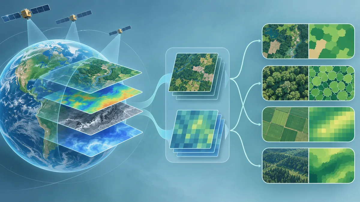
Satellite observations are valuable for studying Earth, but uneven coverage and frequent data gaps can limit what they reveal. Combining observations from multiple sources can also demand substantial computing and careful data harmonization. Earth embeddings offer one possible approach: representations derived from those observations that can be used in a range of later tasks without designing task-specific features and preprocessing from scratch.
Satellite observations provide information used across many areas of environmental research. But uneven coverage and frequent data gaps can limit how well they capture changes at Earth’s surface. Working with observations from multiple sources can bring another challenge: substantial computing and sophisticated data harmonization may be required.
Earth embeddings are presented as one way to work with these data. They are general-purpose representations derived from multi-source Earth observations, intended to support a range of later tasks without requiring task-specific feature design and preprocessing. The key question is how useful these representations are in practice—and whether they outperform conventional satellite imagery or hand-crafted features.
In Earth Embeddings in Environmental Remote Sensing, Yuchi Ma and colleagues review the approach and examine its performance in several applications. Their conclusion is qualified: embeddings have advantages, but current products do not always outperform the alternatives.
A reusable starting point
In a typical remote-sensing analysis, the data and preparation needed depend on the question being asked. Earth embeddings aim to provide representations that can be applied across different downstream tasks, rather than requiring a new set of task-specific features and preprocessing for each one.
This general-purpose design is a potential convenience, not a guarantee of better performance. Whether an embedding is a suitable choice depends on the task. The paper’s abstract describes embeddings as representations that provide stable information across space and time, while cautioning against treating them as replacements for conventional Earth-observation data.
Review and four task evaluations
The authors first introduce theoretical foundations for Earth embeddings and review representative products. They also examine applications across six major domains of environmental remote sensing. In addition to that review, they systematically assess performance in four downstream tasks: hyperspectral image classification, individual tree crown segmentation, crop yield prediction and aboveground biomass mapping.
Together, these tasks test embeddings in several kinds of analysis, from classifying hyperspectral images to segmenting tree crowns and making predictions about agricultural yield or biomass. The abstract does not identify the specific datasets, embedding products, evaluation metrics or numerical results for the individual tasks. It therefore does not allow a task-by-task account of which approach performed best or by how much.
No universal winner
The review and case studies suggest that Earth embeddings have advantages over conventional Earth-observation data, but do not always outperform remote-sensing imagery or hand-crafted features. The authors’ recommendation follows from that mixed finding: embeddings should not be viewed as direct replacements for conventional data. Practitioners should assess whether they suit a specific task and use them strategically, rather than assume that they will perform better by default.
That is a narrower claim than saying embeddings are ineffective. The authors present them as representations that can provide stable information across space and time, and as a way to support downstream tasks without task-specific feature design and preprocessing. But the abstract does not quantify the practical benefits of these capabilities, or establish that they improve results in every setting.
What remains unclear from the available source
The abstract gives the study’s broad design and main conclusion, but not enough information to inspect how the four evaluations were conducted. It does not report the detailed comparisons, data used, or task-specific outcomes. Those details would be needed to understand the size and context of performance differences and to judge how each result applies beyond the stated evaluations. This limitation concerns what the abstract reports; it does not show what details may be available in the full paper.
The source record identifies the work as an arXiv preprint, version 1. The supplied information does not establish its peer-review status, so no claim about that status is warranted here. On the evidence available, the practical takeaway is straightforward: Earth embeddings are a promising option to evaluate, not a guaranteed upgrade. Their value depends on how they perform for the application in question.
- Earth embeddings
- remote sensing
- Earth observation
- environmental monitoring
- machine learning
- geospatial data
Related reading
Automatically matched by shared topic keywords. These links do not imply that the sources agree or establish a consensus.
AI satellite analysts struggle to separate land change from sensor change
Source published
Shared keywords: earth observation, remote sensing
Learning to map building damage from a few confirmed examples
Source published
Shared keywords: remote sensing
Satellite links detect rain better when neighboring receivers share information
Source published
Shared keywords: environmental monitoring, machine learning
Can remote-sensing AI learn without perfectly matched pairs?
Source published
Shared keywords: remote sensing
Can an AI disaster report show its evidence?
Source published
Shared keywords: remote sensing