TRANSMISSION // 2611.13299v1
Freezing mud could have built ice-cored hills on Ceres
Source published
Computer models suggest that shallow, impact-heated deposits could supply enough water to build some mysterious hills in Ceres’ Occator Crater, without drawing on deep brine reservoirs.
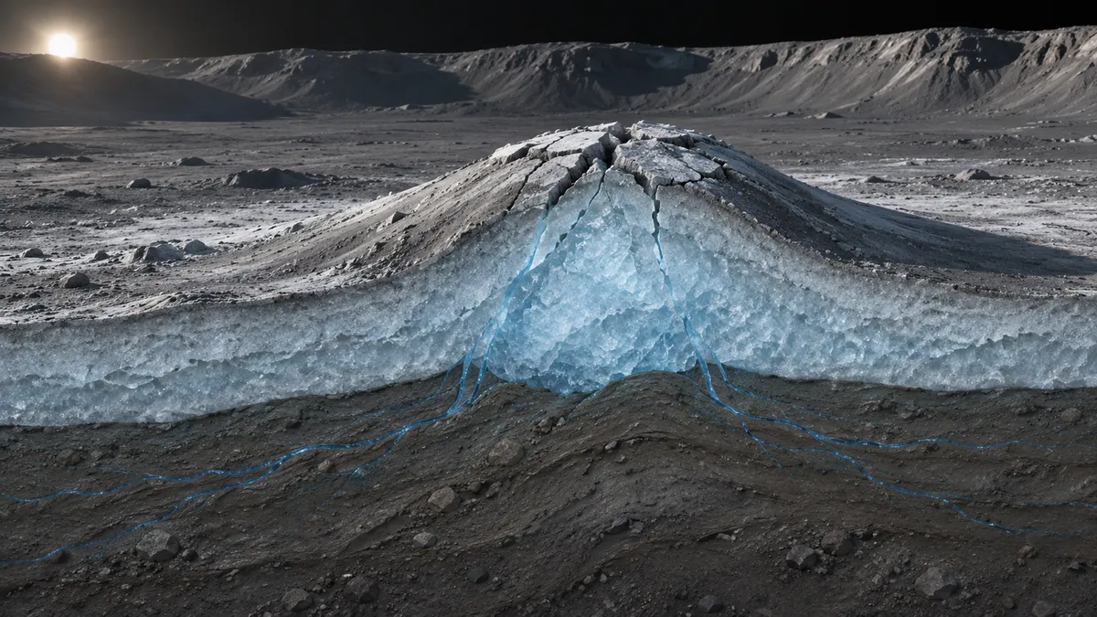
Freezing water can do more than turn solid: it can push remaining liquid through the ground. A new preprint explores whether that process helped build hills inside Occator Crater on the dwarf planet Ceres. The simulations make a shallow water source plausible, but they do not establish that the hills contain ice cores—or that this is how they formed.
NASA’s Dawn spacecraft photographed small, sometimes summit-cracked hills on the floor of Occator Crater, a 92-kilometer-wide impact scar. Their shapes resemble terrestrial pingos: hills lifted as pressurized groundwater feeds growing bodies of ice beneath the surface. Resemblance alone cannot establish a shared origin, however. The question is whether Ceres could supply the water and pressure needed to build them.
In a preprint submitted to JGR: Planets, A. R. Kubas, H. G. Sizemore and B. E. Schmidt investigate a source close beneath the hills. Rather than requiring brines to rise from deep inside Ceres, their proposed mechanism uses the muddy deposits left by the impact itself.
On this ice-rich world, an impact can melt buried ice and leave a slurry of mineral particles, salts and water. As that deposit cools from above, an increasingly thick frozen lid develops. Water expands as it freezes, squeezing some remaining liquid out of the spaces between particles. The resulting pressure differences can drive groundwater through the still-unfrozen material. If water reaches a suitable location near the surface and freezes there, it could help raise an ice-cored hill.
To test the water supply, the researchers adapted a modeling approach previously used for pingos in Svalbard. They focused on a roughly 211-square-kilometer deposit in southeastern Occator containing 20 candidate hills. Their model assumed a deposit 600 meters thick, with its surface elevations taken from Dawn-derived terrain data.
First, 36 heat-transfer simulations explored different amounts of pore space, internal heating and freezing behavior. The latter matters because salts and confinement within tiny pores can keep some water liquid below its usual freezing temperature. The team then used selected cooling histories to drive 19 three-dimensional groundwater simulations with the USGS MODFLOW software. These also varied how readily water passed through the material and how much it could store as pressure changed.
The modeled deposits froze completely in approximately 3,000–8,000 years. Across much of the tested range, freezing supplied enough water to meet or exceed the authors’ estimated minimum requirement for pingo formation. The most restrictive, poorly permeable scenarios could leave too little water available; more permeable scenarios often delivered far more than the hills could contain.
That distinction complicates the result. The researchers estimated hill volumes and counted delivered water equal to 10–90% of a hill’s volume as favorable, using terrestrial ice-core estimates as a guide. No simulation placed all 20 hills within that interval; the best runs placed seven there. But water passing through a pingo system need not all remain as ice, so exceeding the interval does not necessarily rule out formation. The authors explicitly caution that their chosen scenarios are not statistical samples and cannot establish a probability that the hills are pingos.
The pressure calculations also identified conditions sufficient to fracture the overlying material in 15 of 19 scenarios, assuming a strength representative of frozen clay. Such fractures could provide additional routes for water. The study did not simulate their growth or establish whether they would reach the surface.
Several assumptions limit how literally to read the water budgets. The hills were represented as outlets, with pathways through the frozen lid assumed to exist at their locations. Water discharged there was treated as available to build ice cores; the model did not calculate the actual growth and deformation of a hill. The subsurface was also assumed uniform, despite the likely complexity of an impact deposit.
Other choices could inflate delivery. A thinner deposit would contain less water, while cold brines could flow more slowly than the constant, pure-water viscosity used in the calculations suggests. Conversely, the numerical treatment removed some water as layers froze. The authors assume that this loss approximately offsets an overestimate elsewhere, rather than demonstrating that balance.
The result is a plausible water-supply mechanism, not confirmation of extraterrestrial pingos. It also does not exclude deep brine sources elsewhere in Occator. Future ground-penetrating radar could search for massive buried ice and map subsurface layers, while sharper imaging and spectroscopy could seek signs of brine escape. Those measurements would help distinguish hills built by freezing groundwater from look-alikes.
- Ceres
- Occator Crater
- pingos
- groundwater
- impact melt
- planetary ice
- Dawn mission