TRANSMISSION // 2611.12936v1
LandslideFM pairs landslide mapping with image-based descriptions
Source published
A preprint reports improved landslide detection, mapping and scene description by combining specialized image analysis with a vision-language model. Its benchmark results are promising, but they do not establish reliable hazard forecasting or safe emergency advice.
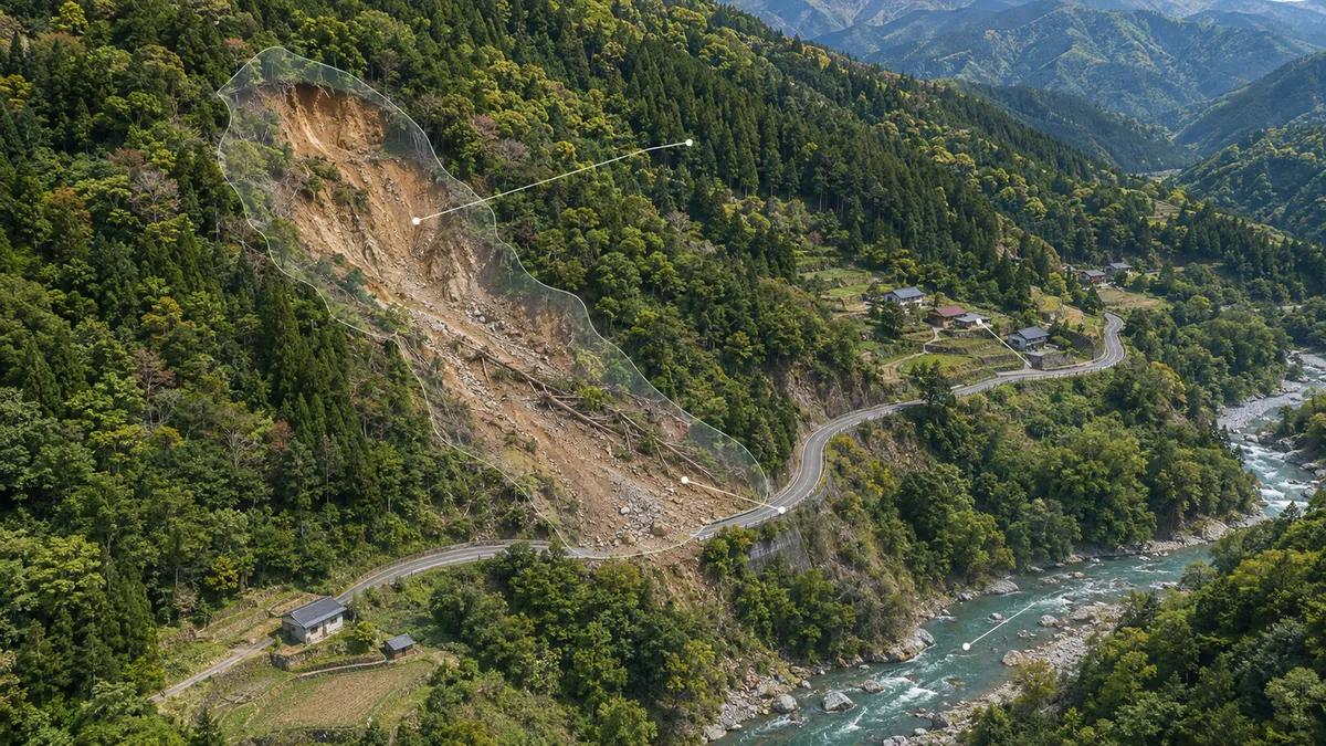
Finding a landslide in a satellite image and explaining what surrounds it are different tasks. A damaged slope may be visible, but assessing nearby roads, buildings and water requires additional interpretation. Researchers Shanwen Wang, Sirui Wang, Xin Sun and Jungong Han propose LandslideFM, a system that connects these tasks. Their preprint reports gains on existing image datasets and a new image-and-text benchmark, while leaving important questions about geographic generalization and the reliability of its written assessments.
Learning from images without complete labels
LandslideFM has two main stages. First, it learns visual features for recognizing landslides, drawing boxes around them and outlining affected pixels. Second, it supplies an original image and a version overlaid with predicted landslide regions to a vision-language model, which generates answers about the scene.
The visual training method, called Source-Agreement Graduated Trust, combines images with human labels and images without them. A teacher model supplies provisional labels for unlabeled images, while the Segment Anything Model supplies region information. A student model learns from these signals, and the teacher is gradually updated from the student.
The distinctive choice is how the system handles disagreement. Rather than automatically discarding regions where the two sources conflict, it assigns different training weights according to their confidence and agreement. Confident, agreeing predictions receive the highest weight; confident but conflicting predictions receive less. The intention is to retain some learning signal from difficult boundaries without trusting every provisional label equally.
For language generation, the researchers use LoRA, a fine-tuning technique that trains relatively small parameter additions while keeping the underlying model weights frozen. The highlighted landslide regions provide spatial guidance, but the resulting descriptions still depend on the language model’s interpretation.
What the experiments found
The researchers evaluated visual tasks on the Bijie and Global Very High Resolution Landslide Mapping datasets, using an 80:20 training–test split. Segmentation experiments included settings in which only one-eighth or one-quarter of the training images had labels.
With one-eighth labeled, LandslideFM achieved a mean intersection-over-union score of 87.33% on the global dataset, compared with 80.54% for UniMatch v2, the strongest competing method in that table. This metric measures overlap between predicted and reference regions, averaged here across landslide and background classes. On Bijie, the corresponding scores were 80.47% and 77.90%.
An experiment removing the graduated treatment of disagreement reduced the global dataset score from 87.33% to 83.45%. That supports the value of retaining weighted information from disputed regions within this experimental setup.
The full-label model also led the reported classification and object-detection comparisons. However, its box-overlap scores remained below 70% on Bijie and 60% on the global dataset. Detection reference boxes were derived from segmentation masks rather than independently annotated, which limits what those results establish about operational detection.
A benchmark for describing landslide scenes
The team also assembled LandslideVL: 4,660 selected images from three existing datasets, including satellite and drone imagery. Paid human annotators supplied detailed descriptions and five yes-or-no attributes: landslide presence, buildings, roads, water and vegetation. The authors report multiple rounds of annotation checking.
On these structured attributes, LandslideFM achieved an average F1 score of 93.82%, compared with 74.96% for Qwen3-VL-8B, the strongest general-purpose comparison model by that measure. F1 balances precision and recall. Improvements were not uniform: LandslideFM detected more buildings, roads and water features, but its precision for those attributes was below that of some comparison models.
Its detailed descriptions also scored higher on text-overlap measures. Reported BLEU rose to 13.16%, versus 0.57% for the best baseline. These metrics measure similarity to reference wording, however—not whether an explanation of slope stability or a safety recommendation is correct.
Mapping is not hazard forecasting
The findings come from a preprint, not an established operational evaluation. The comparisons also involve different training advantages: LandslideFM uses domain-specific fine-tuning and, for some visual comparisons, additional unlabeled images. The results therefore demonstrate the performance of the combined approach, not a benefit attributable solely to its architecture.
The paper reports an 80:20 split for visual experiments, but does not clearly establish geographically independent testing across the pipeline. Because some imagery was cropped into patches, that distinction matters when judging performance in unfamiliar locations. The reported tables also provide no confidence intervals or variation across repeated runs.
Most importantly, visible proximity to a road or settlement does not establish imminent failure, likely casualties or evacuation needs. The study does not validate its generated recommendations against field investigations or emergency outcomes. LandslideFM offers evidence for improved image mapping and benchmark scene description; dependable hazard assessment remains a separate, unproven capability.
- landslides
- remote sensing
- semi-supervised learning
- vision-language models
- LandslideFM
- LandslideVL
- hazard assessment
Related reading
Automatically matched by shared topic keywords. These links do not imply that the sources agree or establish a consensus.
Two AI Teachers Take on the Problem of Learning from Mistakes
Source published
Shared keywords: semi supervised learning
Learning to map building damage from a few confirmed examples
Source published
Shared keywords: remote sensing
AI satellite analysts struggle to separate land change from sensor change
Source published
Shared keywords: remote sensing
Can a vision-language model tell an injected concept from a picture?
Source published
Shared keywords: vision language models
AtariBench exposes AI models’ difficulty turning moving images into reliable actions
Source published
Shared keywords: vision language models