TRANSMISSION // 2610.37306v2
Why farming spread beyond its first climates
Source published
A preprint finds that stronger temperature seasonality is associated with earlier farming adoption, while neighboring farmers help explain its spread. Submerged coastlines offer possible missing locations, but not evidence of lost agricultural origins.
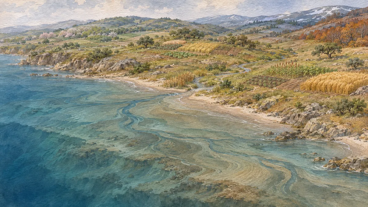
Rising seas erased ancient coastlines—and potentially part of farming’s early history. A new analysis asks how much those losses matter, alongside seasonal climate, population pressure and the growing range of environments farmers could use.
What made farming take root?
Why did people begin farming, and why did it spread? Warmer conditions, seasonal food shortages, population pressure and knowledge arriving from neighbors offer different, potentially overlapping explanations.
In a preprint, Ridhika Mishra and Richard S. J. Tol compare these possibilities while examining a geographical blind spot: land exposed after the last ice age that is underwater today. Their results distinguish three questions that are easily blurred together—where agriculture originated independently, how it spread, and how its environmental range expanded.
The strongest recurring climate association concerns temperature seasonality, rather than warmth alone. But the evidence is more robust for farming’s adoption than for its independent invention.
Comparing places across thousands of years
The researchers combine archaeological adoption dates with reconstructed population, cropland, vegetation, sea level and climate. Their main agricultural dataset covers 1,090 geographical cells in 500-year intervals. It records seven independent invention events; one extension adds an eighth in New Guinea.
They first replicate Andrea Matranga’s 2024 research on seasonality. The proposed mechanism is that larger seasonal swings made food storage and settled living more useful, preparing communities for agriculture. The new analysis tests statistical relationships consistent with that explanation; it does not directly observe those prehistoric decisions.
The authors compare two versions of a past-climate simulation and use several statistical approaches. These include models estimating whether agriculture first appears during a given interval and models of how long a location remains without it. They also add earlier population density and whether a neighboring cell already had agriculture.
Seasons and neighbors matter differently
Greater temperature seasonality remains associated with earlier agricultural adoption across alternative climate reconstructions and model specifications. Rainfall seasonality is less consistent: its association loses statistical significance once neighboring agriculture is included in the panel-logit adoption models. In the Cox duration models, however, it remains significant at the weaker 10% threshold with neighboring agriculture included.
Neighboring agriculture has a strong association with subsequent adoption. That supports the importance of spatial spread, but cannot distinguish migrating farmers from existing communities learning agricultural practices.
Independent invention is harder to explain confidently. With only seven or eight recorded events, uncertainty is substantial. In the main invention models, temperature seasonality loses statistical significance under a bootstrap procedure that accounts for geographically clustered observations. The corresponding adoption result survives that check. Another statistical approach offers weaker support for the invention relationship, underscoring its sensitivity to method.
Higher earlier population density is also associated with invention, although the bootstrap evidence reaches only the study’s weaker, 10% significance threshold. Population density does not show a statistically significant association with adoption once other factors are included. These are historical associations, not experimental demonstrations of causation.
Could farming’s beginnings be underwater?
The reconstruction identifies roughly eight million square kilometres of land that was dry and ice-free in 10,000 BCE but submerged by 5,000 BCE.
The authors examine this missing landscape in two ways. First, they outline the temperature-and-rainfall conditions occupied by reconstructed early cropland—a climatic envelope—and ask which submerged areas would fit inside it. Holding sea level at its earlier position would leave about 5% more land inside that envelope globally in 5,000 BCE. This is potential climatic suitability, not an estimate of farmland actually lost.
Second, they extend their invention models to submerged locations. Some areas around the Persian Gulf, Mediterranean and Yellow Sea receive nonzero predicted probabilities of invention before inundation. Most cell-level predictions are low, and the leading locations change with the model. One specification produces a maximum near 31% in the Gulf of Suez.
That number is a model extrapolation, not archaeological evidence that farming originated there. The two methods also answer different questions: matching an early farming climate is not the same as matching the broader conditions associated with recorded invention sites.
Expansion beyond the original climate range
The reconstructed climatic envelope expands from about five million square kilometres of potentially suitable land in 9,000 BCE to roughly 125 million around the beginning of the Common Era. Neither figure represents actual cultivated acreage.
The authors separate this change into contributions from sea level, ice cover, climate and expansion of the envelope itself. They average across different calculation orders because the factors interact.
They attribute almost all the net expansion to the widening envelope, interpreting it as technological progress that allowed farming in previously unused climates. Its contribution exceeds 100% because sea-level rise offsets some gains. However, this interpretation does not independently measure particular inventions or establish how much each farming innovation contributed.
An incomplete record
Missing archaeological evidence is treated as absence of agriculture, although sites are unevenly investigated and underwater remains are difficult to study. Ancient population maps are reconstructions, not censuses; the counterfactual scenarios redistribute a fixed global population. Climate uncertainty is explored using two reconstructions from one underlying model, not a broad ensemble.
The study therefore supports a qualified picture: seasonality and neighboring agriculture help explain adoption, while changing farming capabilities may explain much of agriculture’s expanding climatic reach. Submerged coastlines remain plausible gaps in that history—not demonstrated lost birthplaces.
- agricultural origins
- climate seasonality
- sea level rise
- Neolithic transition
- agricultural diffusion
- paleoclimate
- economic history
Related reading
Automatically matched by shared topic keywords. These links do not imply that the sources agree or establish a consensus.